

Yellow Publications
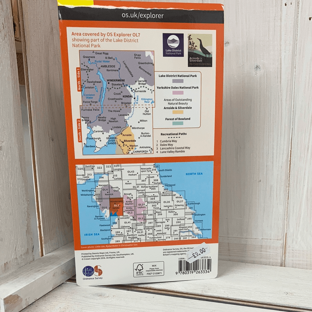
The English Lakes South Eastern Area (OL 7) Explorer Map
The English Lakes South Eastern Area (OL 7) Explorer Map
Precio habitual
£12.99 GBP
Precio habitual
Precio de oferta
£12.99 GBP
Impuestos incluidos.
Los gastos de envío se calculan en la pantalla de pago.
Cantidad
No se pudo cargar la disponibilidad de retiro
OL7 - Explorer Map covering the South Eastern Area of the Lake District including the Lake District National Park, the Arnside and Silverdale Area of Outstanding Natural Beauty, South Cumbria and the tip of Lancashire.
Towns covered include - Arnside, Silverdale, Windermere, Kendal, Grange Over Sands, Kendal, Ambleside, Coniston and Grasmere.
Share